চিত্র:LocationTrinidadAndTobago.png
এর চেয়ে বেশি রেজোলিউশন লভ্য নয়।
LocationTrinidadAndTobago.png (২৫০ × ১১৫ পিক্সেল, ফাইলের আকার: ৬ কিলোবাইট, এমআইএমই ধরন: image/png)

|
This locator map image could be re-created using vector graphics as an SVG file. This has several advantages; see Commons:Media for cleanup for more information. If an SVG form of this image is available, please upload it and afterwards replace this template with
{{vector version available|new image name}}.
It is recommended to name the SVG file “LocationTrinidadAndTobago.svg”—then the template Vector version available (or Vva) does not need the new image name parameter. |
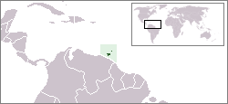
Location map for the Trinidad and Tobago.
Originally created for English Wikipedia by Vardion.
| |
এই কাজের প্রণেতা Vardion ইংরেজি উইকিমিডিয়া কমন্স প্রকল্পের কাজটি পাবলিক ডোমেইনে প্রকাশ করেছেন। এটি বিশ্বব্যাপী প্রযোজ্য হবে। যে ক্ষেত্রে এটি আইনত সম্ভব নয়: |
ফাইলের ইতিহাস
যেকোনো তারিখ/সময়ে ক্লিক করে দেখুন ফাইলটি তখন কী অবস্থায় ছিল।
| তারিখ/সময় | সংক্ষেপচিত্র | মাত্রা | ব্যবহারকারী | মন্তব্য | |
|---|---|---|---|---|---|
| বর্তমান | ০৩:১২, ২০ ডিসেম্বর ২০০৪ | | ২৫০ × ১১৫ (৬ কিলোবাইট) | EugeneZelenko | Location map for the Trinidad and Tobago.<br/>Originally created for English Wikipedia by Vardion.<br/>{{PD}}<br/>Category:Country locator maps |
ফাইলের ব্যবহার
নিম্নলিখিত পাতাটি এই ফাইল ব্যবহার করে:
ফাইলের বৈশ্বিক ব্যবহার
নিচের অন্যান্য উইকিগুলো এই ফাইলটি ব্যবহার করে:
- als.wikipedia.org-এ ব্যবহার
- ar.wikipedia.org-এ ব্যবহার
- ar.wikinews.org-এ ব্যবহার
- awa.wikipedia.org-এ ব্যবহার
- azb.wikipedia.org-এ ব্যবহার
- ba.wikipedia.org-এ ব্যবহার
- be-tarask.wikipedia.org-এ ব্যবহার
- be.wikipedia.org-এ ব্যবহার
- bg.wikipedia.org-এ ব্যবহার
- bo.wikipedia.org-এ ব্যবহার
- bpy.wikipedia.org-এ ব্যবহার
- bs.wikipedia.org-এ ব্যবহার
- da.wikipedia.org-এ ব্যবহার
- de.wikipedia.org-এ ব্যবহার
- de.wiktionary.org-এ ব্যবহার
- dsb.wikipedia.org-এ ব্যবহার
- en.wikipedia.org-এ ব্যবহার
- User:DanielZM/test
- Trinidad and Tobago cuisine
- Biota of Trinidad and Tobago
- List of transcontinental countries
- Area code 868
- User:TheGrappler/North America directory
- List of Trinidad and Tobago–related topics
- Talk:South America/Archive 1
- Portal:Caribbean/Selected cuisine
- Portal:Caribbean/Selected cuisine/5
- LGBT rights in Trinidad and Tobago
- Talk:North America/Archive 2
- Outline of Trinidad and Tobago
- Wikipedia:WikiProject Trinidad and Tobago/Index of Trinidad and Tobago–related articles
- Environment of Trinidad and Tobago
- Portal:Trinidad and Tobago
- Portal:Trinidad and Tobago/Intro
- Colonization attempts by Poland
- List of non-marine molluscs of Trinidad and Tobago
- List of scorpions of Trinidad and Tobago
- List of Opiliones of Trinidad and Tobago
- List of mantids of Trinidad and Tobago
- en.wikivoyage.org-এ ব্যবহার
- eo.wikipedia.org-এ ব্যবহার
- eo.wiktionary.org-এ ব্যবহার
- es.wikipedia.org-এ ব্যবহার
এই ফাইলের অন্যান্য বৈশ্বিক ব্যবহার দেখুন।