চিত্র:LocationRomania.png
এর চেয়ে বেশি রেজোলিউশন লভ্য নয়।
LocationRomania.png (২৫০ × ১১৫ পিক্সেল, ফাইলের আকার: ৭ কিলোবাইট, এমআইএমই ধরন: image/png)

|
This locator map image could be re-created using vector graphics as an SVG file. This has several advantages; see Commons:Media for cleanup for more information. If an SVG form of this image is available, please upload it and afterwards replace this template with
{{vector version available|new image name}}.
It is recommended to name the SVG file “LocationRomania.svg”—then the template Vector version available (or Vva) does not need the new image name parameter. |
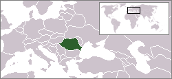
English: Location map of Romania.
Originally created for English Wikipedia by Vardion.
| |
এই কাজের প্রণেতা Vardion ইংরেজি উইকিমিডিয়া কমন্স প্রকল্পের কাজটি পাবলিক ডোমেইনে প্রকাশ করেছেন। এটি বিশ্বব্যাপী প্রযোজ্য হবে। যে ক্ষেত্রে এটি আইনত সম্ভব নয়: |
ফাইলের ইতিহাস
যেকোনো তারিখ/সময়ে ক্লিক করে দেখুন ফাইলটি তখন কী অবস্থায় ছিল।
| তারিখ/সময় | সংক্ষেপচিত্র | মাত্রা | ব্যবহারকারী | মন্তব্য | |
|---|---|---|---|---|---|
| বর্তমান | ২০:৪৫, ২ এপ্রিল ২০০৯ | | ২৫০ × ১১৫ (৭ কিলোবাইট) | D.h | Reverted to version as of 20:37, 2 April 2009 |
| ২০:৩৭, ২ এপ্রিল ২০০৯ |  | ২৫০ × ১১৫ (৬ কিলোবাইট) | D.h | Reverted to version as of 23:25, 6 July 2007 | |
| ২০:৩৭, ২ এপ্রিল ২০০৯ |  | ২৫০ × ১১৫ (৭ কিলোবাইট) | D.h | Reverted to version as of 20:22, 8 September 2007 | |
| ০২:০২, ১ মার্চ ২০০৯ |  | ১,৬০০ × ১,২০০ (৪৭০ কিলোবাইট) | Olahus | Romania in EU | |
| ২০:২২, ৮ সেপ্টেম্বর ২০০৭ |  | ২৫০ × ১১৫ (৭ কিলোবাইট) | Skatefreak | Reverted to version as of 11:48, 4 June 2006 | |
| ২৩:২৫, ৬ জুলাই ২০০৭ |  | ২৫০ × ১১৫ (৬ কিলোবাইট) | Dove | Location of the Romania {{GFDL}} Category:Locator maps for former territories | |
| ১১:৪৮, ৪ জুন ২০০৬ |  | ২৫০ × ১১৫ (৭ কিলোবাইট) | Rain74 | added Serbia-Montenegro border | |
| ১৫:০৮, ৯ ডিসেম্বর ২০০৪ |  | ২৫০ × ১১৫ (৭ কিলোবাইট) | EugeneZelenko | Location map for the Romania.<br/>Originally created for English Wikipedia by Vardion.<br/>{{PD}}<br/>Category:Country locator maps |
ফাইলের ব্যবহার
নিম্নলিখিত পাতাটি এই ফাইল ব্যবহার করে:
ফাইলের বৈশ্বিক ব্যবহার
নিচের অন্যান্য উইকিগুলো এই ফাইলটি ব্যবহার করে:
- arc.wikipedia.org-এ ব্যবহার
- av.wikipedia.org-এ ব্যবহার
- bg.wikipedia.org-এ ব্যবহার
- bo.wikipedia.org-এ ব্যবহার
- bpy.wikipedia.org-এ ব্যবহার
- br.wikipedia.org-এ ব্যবহার
- bs.wikiquote.org-এ ব্যবহার
- ca.wikipedia.org-এ ব্যবহার
- ckb.wikipedia.org-এ ব্যবহার
- de.wikinews.org-এ ব্যবহার
- dsb.wikipedia.org-এ ব্যবহার
- el.wiktionary.org-এ ব্যবহার
- en.wikipedia.org-এ ব্যবহার
- en.wikinews.org-এ ব্যবহার
- en.wikivoyage.org-এ ব্যবহার
- en.wiktionary.org-এ ব্যবহার
- es.wikinews.org-এ ব্যবহার
- eu.wiktionary.org-এ ব্যবহার
- fiu-vro.wikipedia.org-এ ব্যবহার
- fr.wikinews.org-এ ব্যবহার
- gu.wikipedia.org-এ ব্যবহার
- he.wikivoyage.org-এ ব্যবহার
- hu.wikipedia.org-এ ব্যবহার
- hu.wikinews.org-এ ব্যবহার
- ia.wikipedia.org-এ ব্যবহার
- incubator.wikimedia.org-এ ব্যবহার
এই ফাইলের অন্যান্য বৈশ্বিক ব্যবহার দেখুন।